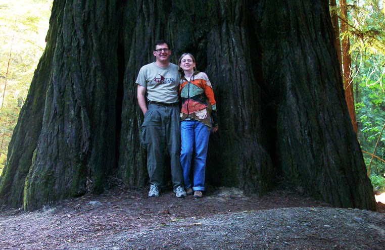
Pam and Scott with a redwood tree in "Avenue of the Giants" in nothern California
If you’ve been reading the posts as I’ve posted them, then consider this the epilogue. If you’re just now finding this blog and plan to read the entries below, consider this the prologue.
 Winery in Napa Valley
We went to the west coast back in July. We flew from Dayton to Chicago to San Francisco, rented a car and drove north to Seattle, and almost three weeks after we left, we got on the plane in Seattle and our first layover was back in…San Francisco.
Here are some random notes and photos that didn’t really fit in the other posts.
 Public artwork in downtown Seattle
Airplanes and Horoscopes : I’m not a big fan of flying, and the last time we’d flown was before 9/11, so taking off our shoes and opening up the carry-on with the laptop was new for us. While sitting in the Dayton airport waiting for the first leg of our trip, I was trying to distract myself by doing the crossword puzzle. Scott pointed out that my horoscope read “Get out of town with a favorite person. You both need time off to rejuvenate and refresh. Spending time outdoors replenishes your spirit.”
 My ginger ale can on the flight to San Francisco
.
At least I hope it's ginger ale.
Local Pronunciation : Apparently we’ve been mispronouncing “Oregon” all of our lives. People who live there pronounce it “OreyGun.” I was corrected by Oregonians more than once. (And for those of you who live in the Dayton area, how do you pronounce the historic area downtown near 5th Street? Say it without thinking and you probably call it the "OreyGun" District.)
Also the river that runs through Portland is “Willamette” and rhymes with dammit, and the nice little park on the west side of Portland is “Couch” and rhymes with “pooch.”
 View of the Columbia River at Bridal Veil Falls in Oregon, looking across to Washington.
Gasoline : Oregon is one of two states (that I know of) that don’t allow you to pump your own gas. The other state is New Jersey. Scott really prefers to pump his own gas, so when we visited the
Columbia River Gorge area and crossed over to Washington to see Beacon Rock, we made sure to fill up the gas tank before returning to Oregon.
 Does anyone know what time is it? I don't...the motel in Portland didn't have a clock.
Clocks : Maybe we’re just not that hip and maybe most travelers have cell phones or other devices that they use as alarm clocks. Two of the motels we stayed at (both in Oregon) didn’t have clocks in the room.
 A few of the thousands of windmills we saw driving from
San Francisco to Yosemite.
GPS : When we reserved the rental car, there was an option to also rent a GPS unit. Since we were going to be gone for almost 3 weeks, it was cheaper to just buy a GPS unit, which I wanted anyway. We got it before we left on our trip, took it out for some test drives, and then programmed the locations of the motels we were staying in.
When we got off the plane in
San Francisco and turned it on, it took about 15 minutes before it finally realized that we weren’t in Ohio anymore. I had expected this since other people have mentioned it. What I didn’t expect was that it was speaking in another language! Something screwy in the programming, or some baggage handler playing a joke?
Overall we were really glad to have the GPS, although I did still pack some state maps, which we used on occasion. The GPS had some trouble knowing exactly where we were when we were in downtown in San Francisco and when we were outside of
Silver Falls she wanted us to turn on a road that was market “No Outlet.”
And as much as we loved
Portland, I do wonder about the bridges. There are several bridges that cross the Willamette River which runs through downtown Portland, but there are only TWO bridges that cross the Columbia River which separates Oregon from Washington. When we were driving north to Seattle, there was an accident and traffic was backed up at one of the bridges. The GPS suggested an alternate route crossing the other bridge, but everyone else was doing that also, so that bridge was also backed up. I pulled out the state maps and the next closest bridges are 30 miles east or 30 miles northwest.
All in all it was a good trip, but it's always good to be home again.

 One of the 10 waterfalls at Silver Falls State Park in Oregon.